
Infrastructure Service
- Home
- Our Services
- Infrastructure Service
Infrastructure Service
Complete Civil Infrastructure & BIM Design Services for Roads, Utilities & Bridges
Introduction
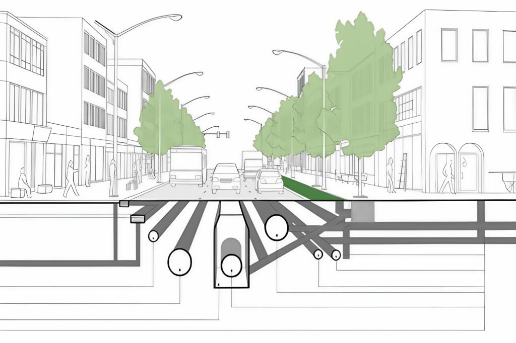
AMC Engineer provides comprehensive infrastructure engineering using Civil 3D and InfraWorks, delivering BIM-coordinated designs for roads, utilities, bridges, and stormwater systems that reduce construction conflicts by 75% and optimize earthwork by 30% for highways, municipalities, and master-planned communities.
What We Offer
- Highway & Roadway Design
- Utility Network Design
- Bridge & Structure Design
- Earthworks & Grading Design
- Stormwater Management
- GIS & Asset Management
Steps Of Work
1.Topographic Survey Integration
Import drone/laser scan data into Civil 3D and establish project coordinate system.
2.Conceptual Alignment Design
Develop preliminary horizontal/vertical alignments with corridor modeling.
3.Detailed Network Design
Pipe networks, intersections, drainage systems, and utility coordination.
4.BIM & Clash Coordination
Navisworks coordination between civil, structural, and underground services.
5.Quantity & Cost Estimation
Earthwork volumes, material takeoffs, and 5D BIM cost modeling.
6.Construction Documentation
Complete plan/profile sheets, cross-sections, and tender packages.